Site Review: Old PCT to Wince Lake Trail
July 30, 2026
version 1.0
Why isn't Wince Lake on my map?
It depends on your map. Some maps don't show it; a few maps show the trail, though inaccurately. But it is there, in the Cle Elum Ranger District of the Mt. Baker / Snoqualmie National Forest, now within the Alpine Lakes Wilderness area. Most maps, such as Green Trails Map #176 and current USGS "The Cradle" maps, show the lake with no label. Most of the trail routes shown for the local area by (even the most current) USGS maps are outdated. If searching online, look for the Cathedral Pass Trail in the state of Washington for general information.
To reach the trailhead, drive state highway 903 north through the hamlets of Roslyn and Ronald. Keep speed low, as you are likely to dodge forest animals from chipmunks to deer to humans. Continue straight ahead into the Salmon La Sac recreation area. As the gravel begins, turn uphill to the right onto the rough lumpy washed-out Cle Elum River Road, where you will want to go much slower. Continue to the end; stop at the first of the two major trailhead parking areas and fill out the registration tag for your trip. A forest "recreation" pass is required for parking.
Warning: this area is very popular, for good reason. Parking areas are jammed to overflowing on weekends, and impossible over holidays.
If you are unfamiliar with the area, you might want to consider visiting one of the better-known places first. There are plenty of them: chilly Marmot Lake, gleaming "Little Enchantments" at Robin Lakes, high and dazzling Peggy's Pond, cobalt blue Deep Lake, and my favorite, Spinola Meadows.
The route
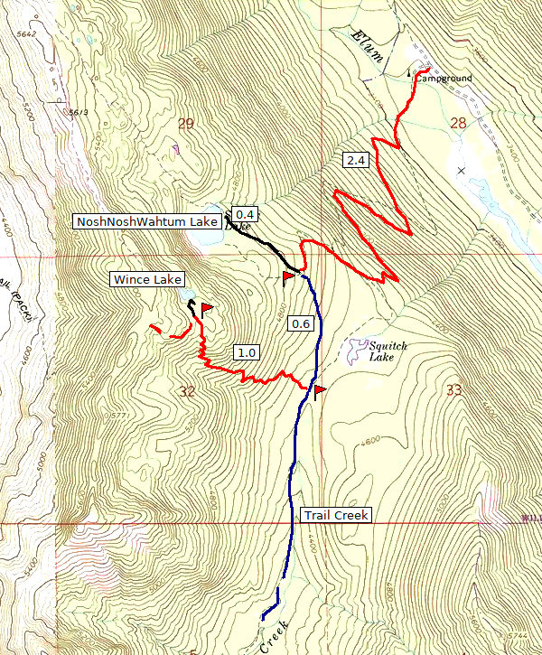
The trip consists of three legs:
- 2.4 miles ascending on switchbacks from 3380 feet to 4760 feet to the shoulder of Cathedral Ridge;
- an ordinarily very gentle 0.6 miles along the historic Trail Creek trail;
- a grueling final 1.0 mile ascent from 4500 feet to 5580 to reach the lake.
To give some perspective, I casually completed the first three miles in 2.5 hours; but it took me the next 2.5 hours to cover that last mile.
To understand the what and why, you need to know the history of this amazing but forgotten area. From the early 1900s, the very well built, comfortable Trail Creek Trail was the focus of travel through the area and the route of the Pacific Crest Trail. However, as routing goes, this was a miserable choice, with excessive elevation gains and losses. It looped all of the PCT traffic through one of the busiest forest recreation areas in the state. The logical solution was to send the PCT traffic up along Spinola Creek to an intermediate location near Deep Lake. From there, it was a shorter and easier climb to Cathedral Pass to establish new PCT connections.
But while these major modifications were under construction, a temporary route was set up from Spinola Meadows, a gorgeous but fragile area a short mile before Deep Lake. This bypass went over the top of Cathedral ridge to reconnect with the old Trail Creek route. It served its purpose, but was steep and rough by PCT standards. It is (inaccurately) shown only in the 1967 edition of the USGS 15 minute "The Cradle" map. But after the new switchbacks above Deep Lake were in service, the USGS 1975 edition of this map showed the new switchbacks and omitted the temporary route.
Wince Lake was a notable feature while the PCT passed near. But after that, there was not much reason to pay any attention.
Finding it — not completely trivial
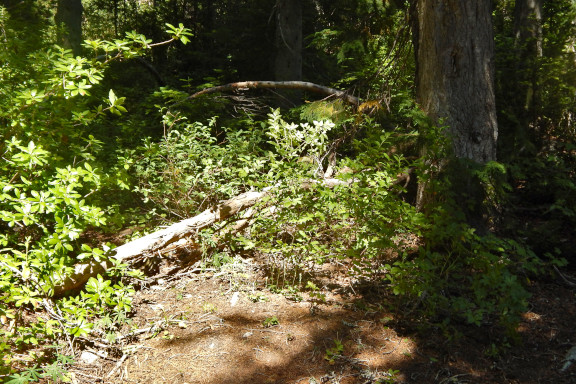
You might want to take note of the GPS waypoint at
lat="47.5251286" lon="-121.1076977" and elevation
approximately 4580 feet. Trail Creek Trail runs left to right in
the image. A couple pieces of blow-down wood might be present, as
seen when this photo was taken, to discourage casual travelers. On
the right, look above the berry brush for an old blaze on the
tree. If you turn around and look the opposite direction, your
eyes might detect the old Trail Creek route slanting downhill to
the left.
What's at the lake?
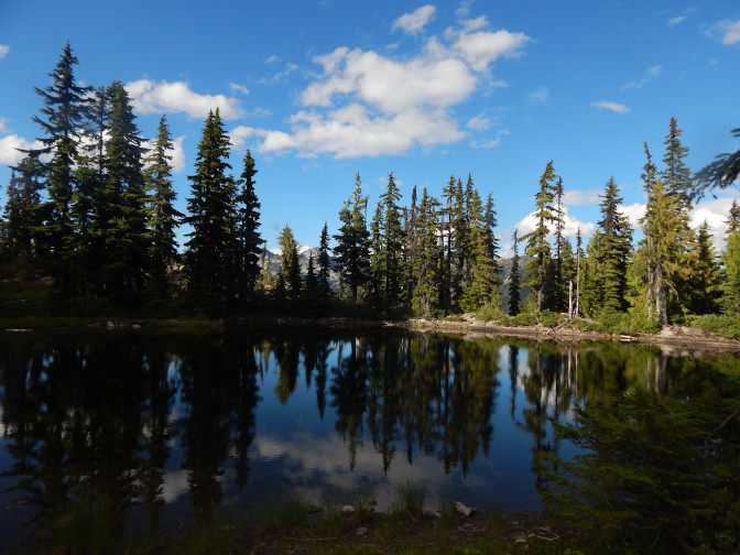
This is the best part. Almost nothing. There is a cozy camp on the south side, where you first arrive, plus a larger but lumpy camp on the north side. The lake is maybe two acres, and that is being generous. There are a few trout that make a rare appearance. Frogs will sometimes sing for you. There are also some shy brown salamanders and blue-metal dragonflies. The water is comfortably cool, but the lake bottom is mooshy (though not sticky mud) hence not appealing for wading. It is QUIET. Just past the lake, there are great views over the Cle Elum River valley.
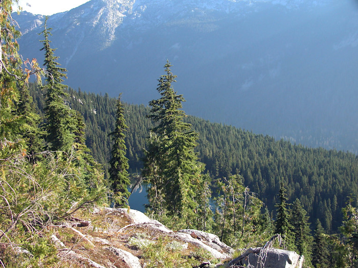
The lake makes a nice stop-over point for continued explorations. About 100 yards before camp, you can find where the old PCT route continues to the west, an easy quarter mile to reach the ridge. From there, an excellent primitive trail along the ridge top can take you over to Cathedral Pass. Or if you are brave (and maybe a little lacking in judgment) you can continue over the ridge 1.2 miles and drop down to Spinola Meadows. (Follow the creek to the left past the first bend to locate the old ford location and reach the PCT.)
The bad news...
Unfortunately, the trail has received nothing but volunteer maintenance since abandonment in the 1960s. There is plenty of loose rock and accumulated forest debris to challenge the footing. The tread a bit rough in many places, though not slippery or dangerous. And worst, due to recent storms, there are now five "project blow-downs," of the kind that make you stop to figure out, "OK, what do I have to do to get past this thing?" Here is my inventory:
- On Trail Creek, about 1/4 mile from the Cathedral Ridge junction
- Blow-down #1 - 0.22 miles
- Blow-down #2 - 0.48 miles
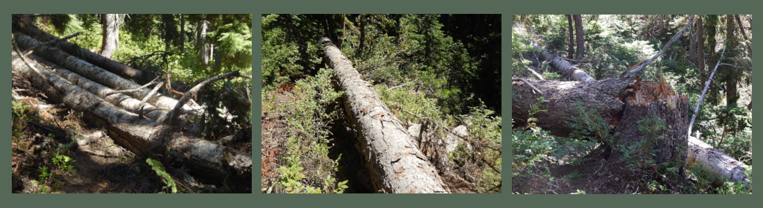
- Blow-down #3 - 0.51 miles
- Blow-down #4 - 0.60 miles
- Blow-down #5 - 0.77 miles
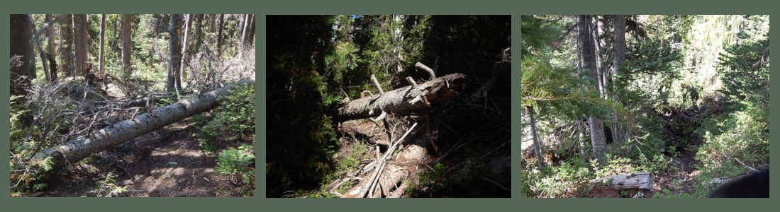
These trees are not particularly large. Back in my day, I would have packed my crosscut saw and dropped these guys down. That might not get them entirely clear, but it can at least eliminate head-scratching decisions about whether to climb over, crawl under, or brush-thrash around. But as I said in my blog comments, I am not exactly in my day any more... maybe this is the last time I will ever get to see little Wince Lake.